
Selling a Coastal Hampton Roads Home: Norfolk's Sinking-City Reality and What It Means for Your Sale
If you own a coastal home in Norfolk, Virginia Beach, Portsmouth, Hampton, or anywhere else along Hampton Roads' extensive shoreline, you've watched the trajectory shift over the past 10 to 20 years. The tidal flooding is more frequent. The flood insurance premiums climb every year. The FEMA maps keep getting redrawn. The conversations at the city level about Vision 2100 and managed retreat get more concrete. We're Hal and Emmy Jones, the husband-and-wife team behind People First House Buyers — and we've been buying Hampton Roads homes, including in coastal Norfolk neighborhoods, for 26 years. We have actually watched the changes from inside.
There's a fact about Norfolk that gets cited in academic research, federal climate reports, and city planning documents but rarely gets said plainly to coastal homeowners: Norfolk is the second-largest U.S. population center at risk from sea-level rise, behind only New Orleans.
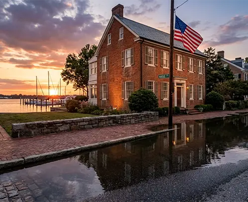
The combination of accelerating ocean rise plus one of the fastest land-subsidence rates in the country means Norfolk has the highest rate of relative sea-level rise on the entire East Coast — per NOAA's Office for Coastal Management. Sewells Point in Norfolk has recorded 17 inches of relative sea-level rise since 1927; the global average over the same period is 7 to 8 inches. NOAA's 2022 projection adds another 15 to 18 inches by 2050.
This page is the honest version of what that means for selling a coastal Hampton Roads home — when to act, what the FEMA and NFIP procedural reality actually requires, where Norfolk's Vision 2100 plan affects long-horizon property decisions, and where a cash sale fits when it does. Our brand promise is people over profit. For many coastal homeowners, elevation, mitigation grant participation, ICC coverage, or continuing to insure and ride the trajectory is the right answer. For others, the math has turned and cash-as-is is the cleanest exit. We'll tell you which honestly.
Get Your Free Cash Offer Now!
Fill out this form to get your no-obligation all cash offer started!
Get Your Free Offer TODAY!
Fill In This Form To Get Your No-Obligation All Cash Offer Started!
The Norfolk Coastal Reality — The Data
Three separate physical processes combine to give Norfolk and the broader Hampton Roads metro the highest rate of relative sea-level rise on the East Coast:
- Ocean sea-level rise. Global ocean levels are rising at approximately 4 mm per year as of recent measurements. This is the global baseline driven by thermal expansion of warming water and melting land ice. See NOAA's Office for Coastal Management for current measurements.
- Chesapeake Bay land subsidence. Per a February 2026 USGS study — the largest research effort of its kind in the region — the average land subsidence rate across the Chesapeake Bay region is 1.4 mm per year, with some Hampton Roads areas measured at up to 5 mm per year by Virginia Tech researchers. See USGS Chesapeake Bay.
- Human contribution. Groundwater withdrawal in southeastern Virginia is faster than aquifer replenishment. The Hampton Roads Sanitation District operates an aquifer recharge program (pumping a million gallons of treated wastewater per day back into the local aquifer) to slow this driver, but it's a partial mitigation.
The sum: Norfolk's relative sea level is rising approximately twice as fast as the global average. Tidal flooding events that were once-a-year occurrences in 1990 are now multiple-times-a-month in many low-lying Norfolk neighborhoods. This is the structural backdrop against which every coastal Hampton Roads home-sale decision is being made.
FEMA Flood Zones and What They Mean
FEMA's Flood Insurance Rate Maps (FIRMs) designate Special Flood Hazard Areas (SFHA) — areas with at least a 1% annual chance of flooding (the '100-year flood' zone). Coastal SFHA designations include A and AE zones (inland flooding) and V and VE zones (coastal high-hazard with wave action). Significant portions of Norfolk, Virginia Beach, Portsmouth, Hampton, and parts of other Hampton Roads cities sit in SFHA.
If your property is in SFHA and you have a federally-backed mortgage (most mortgages), you are required by federal law to carry flood insurance. The 2024 FEMA flood-map update meaningfully expanded SFHA boundaries in parts of Hampton Roads — meaning some properties that were previously outside SFHA are now inside. Check your specific property at FEMA's Flood Map Service Center.
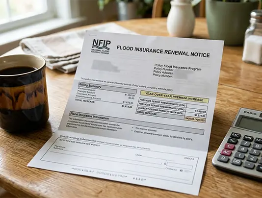
NFIP Risk Rating 2.0 — Why Your Premium Keeps Going Up
FEMA fully implemented its new flood insurance pricing methodology — Risk Rating 2.0 — on April 1, 2023. The new methodology replaces the prior flood-zone-based pricing with individualized risk assessment based on:
- Building characteristics (foundation type, full replacement cost, first floor height).
- Distance to coast (properties within 50 miles of the coast are evaluated against coastal flood risk).
- Elevation of the property relative to the flooding source.
- Specific local flood risks (storm surge, inland flooding, coastal erosion).
Risk Rating 2.0 is actuarially sound and produces premiums that more accurately reflect each property's individual flood risk. For many coastal Hampton Roads properties, this means premiums are climbing every year. Statutory rate caps protect policyholders from sudden shocks:
- 18% per year maximum increase for primary residences.
- 25% per year maximum increase for non-primary residences, business properties, severe repetitive loss properties, substantially damaged/improved properties, and properties with substantial cumulative damage.
- Caps continue annually until full risk-based rates are reached, which can take 10 to 15 years for many properties.
If you've been watching your NFIP premium climb 15-18% every year, this is why. It's not random; it's the gradual market-correction trajectory.
Norfolk Vision 2100 — The City Has a Plan, and It's Public
In 2016, Norfolk adopted Vision 2100 — a long-horizon coastal resilience strategy with an 80-year time frame. The plan was adopted as part of Norfolk's Comprehensive Plan and divides the city into four color-coded zones based on flood vulnerability and civic asset value:
- Red zones — vital civic and economic areas (Naval base, airport, downtown core, historic district). These will receive expanded flood protection investment, comprehensive transportation infrastructure, and denser mixed-use development. The city's strategy here is harden and protect.
- Yellow zones — High Flood Risk / Low Civic Assets. Areas suitable for property buyouts and managed retreat. The Tidewater Gardens neighborhood is specifically identified as a Yellow-zone managed-retreat area. The strategy here is adapt and, where possible, retreat.
- Green zones — future urban growth areas on higher ground. New development will be directed here. The strategy here is grow and concentrate.
- Purple zones — areas of investment opportunity, focused on economic and cultural anchors.
The plan is publicly available on the City of Norfolk website. If your coastal Norfolk property sits in a Yellow zone (or in a Coastal Resilience Overlay district under the 2018 zoning ordinance), the city has publicly signaled where your neighborhood sits in the long-horizon coastal trajectory.
Norfolk Vision 2100 — The City Has a Plan, and It's Public
Effective March 1, 2019, Norfolk's revised zoning ordinance requires all new construction to elevate the lowest floor at least 3 feet above the base flood elevation (BFE) — known as the '3-foot freeboard' standard. New buildings in the 500-year flood zone (0.2% annual chance) must be elevated or flood-proofed to 1.5 feet above the highest adjacent grade or 1.5 feet above the 0.2%-annual-chance flood elevation.
Hampton, Poquoson, and Portsmouth have considered or adopted similar 3-foot freeboard standards. The practical effect on coastal property: existing pre-2019 homes that sit at or below current BFE may face significant elevation, structural alteration, or compliance challenges if they're substantially damaged in a future flood and need to be rebuilt. ICC coverage of up to $30,000 from your NFIP policy may help fund elevation or relocation, but $30,000 doesn't fund a full residential elevation (which can cost $80,000 to $200,000+ depending on the structure).
Where a Cash Sale Fits
A cash sale through People First fits when:
- Your annual NFIP premium increase trajectory has crossed your tolerance line.
- Your property is designated Repetitive Loss or Severe Repetitive Loss and the 25% annual cap is climbing toward a full risk-based rate that doesn't work for your budget.
- Your property sits in a Norfolk Vision 2100 Yellow zone (managed retreat) and you've decided to exit ahead of broader market sentiment.
- You can't or don't want to invest $80K-$200K in elevation.
- Your property has recent flood damage and traditional buyers' financing is failing because of inspection findings or insurability concerns.
A cash sale doesn't fit when: the long-term math still works at current premiums; FEMA mitigation grants or ICC coverage funds practical resilience improvements; the property is in a Red zone (hardening rather than retreat) and the city investment trajectory supports continued ownership; you have the financial capacity and inclination to elevate. People over profit — we'll tell you which scenario you're in honestly.
How a Cash Sale With People First Looks
If you've decided cash sale is the right tool for your coastal Hampton Roads home, here's what working with us looks like:
- Step 1: You call us at (757) 238-5550 or email Hal@peoplefirsthousebuyers.com. We talk through your situation — your flood history, NFIP claims if any, current premium trajectory, Vision 2100 zone if you know it, and your timing.
- Step 2: We walk the property. Hal and Emmy — local, Norfolk-based, husband-and-wife team. We see the home, the elevation, the floor system, the prior flood-damage history if any.
- Step 3: We send a written cash offer within 24 hours. The math accounts for the as-is condition, the flood-risk profile, the local coastal market, and the realistic post-purchase plan we'd have for the property.
- Step 4: If you accept, we coordinate with a Virginia title company. Title work, lender payoff (if any), and closing typically proceed in 7-14 days.
- Step 5: We close. You're out. We take on the coastal-risk profile from here.
Frequently Asked Questions

Talk to Hal Directly
If you own a coastal Hampton Roads home and you're trying to figure out the next 5, 10, or 20 years, give us a call. We'll talk through the FEMA math, the Vision 2100 zone for your specific neighborhood if you're in Norfolk, and what a cash sale would look like — including whether it's the right answer for your situation. People over profit. Honest feedback, even if we're not the best fit. Call (757) 238-5550 or fill out the form. — Hal and Emmy Jones, People First House Buyers.
Get Your Free Offer TODAY!
Fill In This Form To Get Your No-Obligation All Cash Offer Started!