
Norfolk Vision 2100 and Long-Horizon Coastal Property Decisions: What Sellers Need to Know
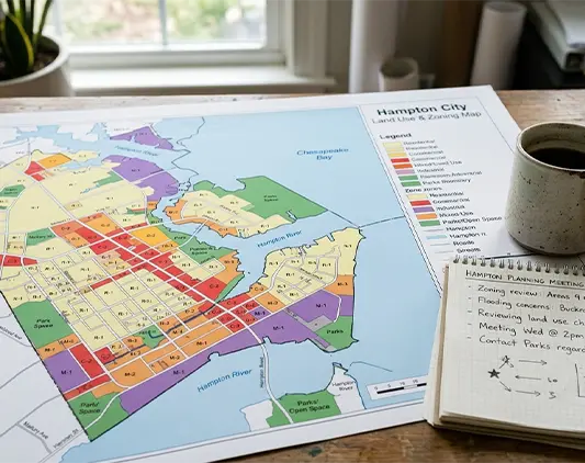
Norfolk Vision 2100 is the City of Norfolk's long-horizon coastal resilience plan. Adopted in 2016 as part of the city's Comprehensive Plan with an 80-year time frame, it represents one of the most comprehensive and publicly documented municipal responses to sea-level rise in the United States. The plan organizes Norfolk into four color-coded zones — Red, Yellow, Green, and Purple — based on flood vulnerability and civic asset value. For coastal property owners across Hampton Roads (Hampton has adopted similar 3-foot freeboard zoning standards, and other neighboring cities are following suit), the framework offers a structured way to think about long-horizon coastal property decisions. We're Hal and Emmy Jones; 26 years of buying Hampton Roads homes. This page walks through what Vision 2100 actually says, how it interacts with Norfolk's 2018 zoning ordinance, and what it means for long-horizon coastal property decisions in Norfolk and the neighboring cities adopting similar frameworks.
Get Your Free Cash Offer Now!
Fill out this form to get your no-obligation all cash offer started!
Get Your Free Offer TODAY!
Fill In This Form To Get Your No-Obligation All Cash Offer Started!
Norfolk Vision 2100 — The Four Zones
Vision 2100 divides Norfolk into four color-coded zones based on flood vulnerability and civic asset value. The plan is publicly available on the City of Norfolk website:
Red Zones — Vital Areas (Harden and Protect)
Red zones include Norfolk's most economically and civically vital areas: Naval Station Norfolk, Norfolk International Airport, the historic downtown core, and adjacent commercial corridors. The strategy in Red zones is to harden and protect — expanded flood protection infrastructure, comprehensive transportation network maintained on 24-hour basis, denser mixed-use development that concentrates economic value in protected areas. The U.S. Army Corps of Engineers' Coastal Storm Risk Management Study (Chief's Report February 2019, originally recommending $1.4 billion in mitigation, with 2026 cost estimates climbing to $6.1 billion) is largely targeted at Red-zone protection.
Yellow Zones — High Flood Risk / Low Civic Assets (Adapt and Retreat)
Yellow zones are residential areas with high flood vulnerability but lower civic asset density. The strategy here is to adapt to rising waters and, where appropriate, support managed retreat through voluntary property buyouts and conservation easements. The Tidewater Gardens neighborhood is specifically identified as a Yellow-zone managed-retreat area. Yellow-zone property owners can expect the city to facilitate buyouts (when funding is available), to direct less new infrastructure investment to these areas, and to maintain the existing flood protection without expanding it.
Green Zones — Future Urban Growth (Grow and Concentrate)
Green zones are higher-elevation areas where Norfolk is directing future urban growth. New residential and mixed-use development is encouraged here through the city's Upland Resilience Overlay zoning district (created in the 2018 ordinance rewrite). Green-zone property values can be expected to benefit from concentrated investment over the multi-decade Vision 2100 horizon.
Purple Zones — Areas of Investment Opportunity
Purple zones are areas of identified investment opportunity — economic and cultural anchors that may not fit the Red/Yellow/Green frameworks cleanly. These include emerging mixed-use districts and other strategic investment areas.
The 2018 Zoning Ordinance — Implementing Vision 2100
Norfolk completed a comprehensive rewrite of its Zoning Ordinance in 2018, effective March 1, 2019. The new ordinance implements Vision 2100 through several pioneering mechanisms:
- Coastal Resilience Overlay (CRO) district. A zoning overlay applied to coastal-vulnerable areas. Development within the CRO must meet stricter resilience requirements; conservation easement credits can be transferred from the CRO to the Upland Resilience Overlay.
- Upland Resilience Overlay district. Areas where the city wants to direct new development. Points are earned by extinguishing development rights in the CRO (i.e., accepting that vulnerable areas should not be re-developed) and applying them to higher-ground development.
- Resilient Quotient point system. All new development across the city must achieve a minimum Resilient Quotient — a flexibility mechanism that lets developers meet resilience requirements through different combinations of design, conservation, and elevation measures.
- Three-foot freeboard requirement. All new construction must elevate the lowest floor at least 3 feet above the base flood elevation. New buildings in the 500-year flood zone (0.2% annual chance) must be elevated/flood-proofed 1.5 feet above the highest adjacent grade or 1.5 feet above the 0.2%-annual-chance flood elevation.
- Open Space Residential Design / Conservation Subdivision. Required for new residential subdivisions, prioritizing preservation of flood-prone areas as open space.
Hampton, Poquoson, and Portsmouth have considered or adopted similar 3-foot freeboard standards and resilience-focused zoning approaches. The trend across Hampton Roads is toward more stringent floodplain management — meaning that existing pre-2019 homes that don't meet current freeboard standards face increasing compliance friction when they need substantial repair or modification.

Long-Horizon Decisions — How Vision 2100 Should Inform Your Sale
If you own coastal property in Norfolk or in a neighboring Hampton Roads city following similar planning frameworks, the Vision 2100-style zone designation should be a factor in your long-horizon decision making. Practical implications by zone:
If You're in a Red Zone
Substantial city investment in flood protection infrastructure is planned. Property values benefit from concentrated investment. Long-horizon hold trajectory is more favorable than other zones. Premium increases under Risk Rating 2.0 still apply, but the city's commitment to protection is real. Selling decisions should weigh the long-horizon stability of Red-zone designation.
If You're in a Yellow Zone
The city has publicly signaled that this neighborhood is appropriate for managed retreat. Property buyouts will be facilitated where funding becomes available. Less new infrastructure investment is planned for the area. Risk Rating 2.0 premiums will continue climbing without offsetting city-level resilience investment. For many Yellow-zone property owners, exiting ahead of broader market sentiment fully pricing in the managed-retreat designation is rational. Cash-as-is sale is the most reliable exit path for Yellow-zone properties with significant existing vulnerability.
If You're in a Green Zone
Higher-ground locations directed for future growth. Long-horizon hold trajectory is favorable. Property values can be expected to benefit from concentrated future investment. Sale decisions here are typically driven by other factors (PCS, downsizing, family changes) rather than coastal-risk math.
If You're in a Purple Zone
Designated investment opportunity area. Trajectory varies by specific Purple-zone designation; check the Vision 2100 plan for your specific property.
Cities Beyond Norfolk — Hampton, Portsmouth, Poquoson
Norfolk has the most comprehensively documented coastal resilience framework in Hampton Roads, but Hampton, Portsmouth, and Poquoson have all adopted or considered similar approaches:
- Hampton has adopted 3-foot freeboard requirements similar to Norfolk's 2018 ordinance.
- Portsmouth has considered similar resilience zoning standards.
- Poquoson has adopted elevated freeboard requirements.
If you own coastal property in these cities, the practical reality is similar even if the specific planning documents are different. The 3-foot freeboard standard, the increasingly stringent floodplain management ordinances, the Risk Rating 2.0 premium trajectory, and the multi-decade sea-level-rise outlook all apply across the metro. Hampton Roads is moving collectively toward more rigorous coastal planning.
When Cash-As-Is Sale Is the Right Tool
Cash-as-is sale through People First fits when your coastal property situation includes:
- Yellow-zone (managed retreat) designation in Norfolk or equivalent in neighboring cities.
- RL or SRL NFIP designation with climbing premium trajectory.
- Recent flood damage you cannot or do not want to repair.
- Pre-2019 home that no longer meets current freeboard standards and faces compliance friction.
- Decision to exit ahead of broader market sentiment fully pricing in coastal risk.
- Inability to fund elevation ($80K-$200K typically) or unwillingness to wait the 1-3 year FEMA grant application cycle.
Cash-as-is doesn't fit when: Red-zone designation with strong city investment trajectory; financial capacity and inclination for elevation; long-horizon hold trajectory still works at current premium levels; mitigation grant pathway is realistic. People over profit — call us; we'll be honest about which scenario you're in.
Call (757) 238-5550 or email Hal@peoplefirsthousebuyers.com. — Hal and Emmy.
Frequently Asked Questions

Talk to Hal Directly
If you've got PCS orders and you want a straight read on your options, give us a call. We'll walk through your VA entitlement math, your timeline, and what a cash sale would look like — including whether it's even the right answer for your situation. People over profit. Honest feedback, even if we're not the best fit. Call (757) 238-5550 or fill out the form. — Hal and Emmy Jones, People First House Buyers.
Get Your Free Offer TODAY!
Fill In This Form To Get Your No-Obligation All Cash Offer Started!